
The City of Semarang City has been developed rapidly from year to year. This can be seen from the stable economic growth supported by a conducive investment climate. From the industrial and trade sectors, this rapid development can also be observed from various new property project developments. Along with these developments, the land degradation problems have occurred in several watersheds as well as land subsidence, especially in the northern part of Semarang. In addition, population growth has also contributed to the damage caused by an increase in the need for availability of land resources and the fulfillment of clean water sources.
Among the 16 districts in Semarang City, North Semarang District is classified as a densely populated area. Several areas are often hit by inundation floods, because of their low location near the coast and also this area is the estuary of major rivers in Semarang. Three factors are suspected to be the cause of inundation in this area, among others (1) the relatively flat topography; (2) the density of residential areas and the lack of regularity of the drainage channels, causing the water flow to not run smoothly; (3) the location is near the coast and is located at the mouth of a river so that when high tide occurs, sea water enters through the river and continues to flow through the drainage channels to the surface.
The Semarang City Government has actually made efforts to overcome the inundation flood disaster by building water canals. Semarang City has two main canals, namely the West Flood Canal (BKT) and the East Flood Canal (BKT). The two canals have the main function of controlling floods in the city of Semarang. However, the capacity of the two channels to carry out their functions properly began to decrease. For example, last December 2021, BKT overflowed and inundated roads and settlements after heavy rains from evening to night. The reduced capacity of canals as flood controllers is caused by high sedimentation, inappropriate use of river space, and accumulation of waste in river bodies.
In mitigating geological disasters, including floods, one approach in disaster management can be done by studying past flood events. The goal is to better understand the sedimentation cycle because flooding itself is a natural event that is closely related to the sedimentation process. Studies on the main causes of flooding in the city of Semarang are currently still limited. In general, flooding occurs when the river is no longer able to hold water so that the water will overflow into the area around the river body. One of the reasons for the reduced capacity of rivers is the high level of sedimentation.
From the geological perspective, one of the methods that can be applied in studying the sedimentation process is by analyzing the physical and chemical characteristics of the sediment. For example, with granulometric and geochemical methods. This analysis is useful in interpreting sediment deposition processes and identifying flood deposits that have occurred in the past. Granulometric analysis or grain size is a method of physical analysis of sediments that will provide important clues regarding the origin of the sediment particles deposited, the history of transportation, and the conditions of sediment deposition. One of the geochemical methods commonly used in sedimentation analysis is X-Ray Fluorescence (XRF). XRF analysis is used to determine the chemical composition of a material. The material being analyzed can be in the form of solid, liquid, or in powder form. The method is fast, accurate and non-destructive and only requires a small sample making XRF a very useful analysis to support data on the chemical element content of a material.

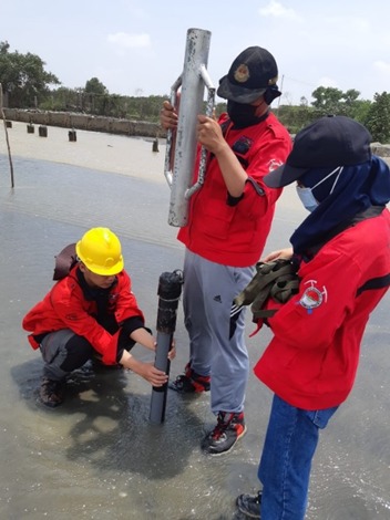
The UNDIP Geological Engineering research team from the Energy Resources Laboratory (SDE) in 2022 has conducted research on the sedimentation process of the two main flood canals in the City of Semarang. This study used grain size analysis and XRF methods to determine the history of sedimentation and trace flooding events at the study site. The object being analyzed is sediment samples taken at the river estuary (offshore) from the two main flood canals of Semarang City, namely the West Flood Canal (BKB) and the East Flood Canal. The results of this study show that the physical condition of the sediment from the grain size analysis of the BKB sample indicated that the transport mechanism was dominantly influenced by fluvial (river) processes, especially at depths of 18 – 22 cm. This is supported by geochemical analysis which shows that the elements Zr, Sr, Fe, Mn, Ti and Ca have increased at these depth intervals. While the elements K, Rb, and Zn show the opposite graph, which is decreasing. The increase in Fe and Mn elements can be an indicator of the stronger influence of deposition from land, or can be interpreted as a flood event. Meanwhile, in the BKT sample grain size analysis, there was no significant difference in the mechanism of each facies, where all facies were deposited under relatively calm water flow conditions. If we look at the pattern of changes in the geochemical composition, there is also no significant change. This shows that sediment deposition in the East Banjar Kanal is not affected or slightly affected by depositional processes from land.

The results of the research team from the Geological Engineering SDE Laboratory above show that flood events in the past can be investigated and traced properly. If this kind of research is carried out a lot, the deeper we will gain knowledge about floods. This can be the basis and reference in formulating policies related to flood control in the city of Semarang.
Author: Anis Kurniasih, S.T., M.T. (Department of Geological Engineering)